|
Ancient
Egypt by Sjef Willockx |
||
|
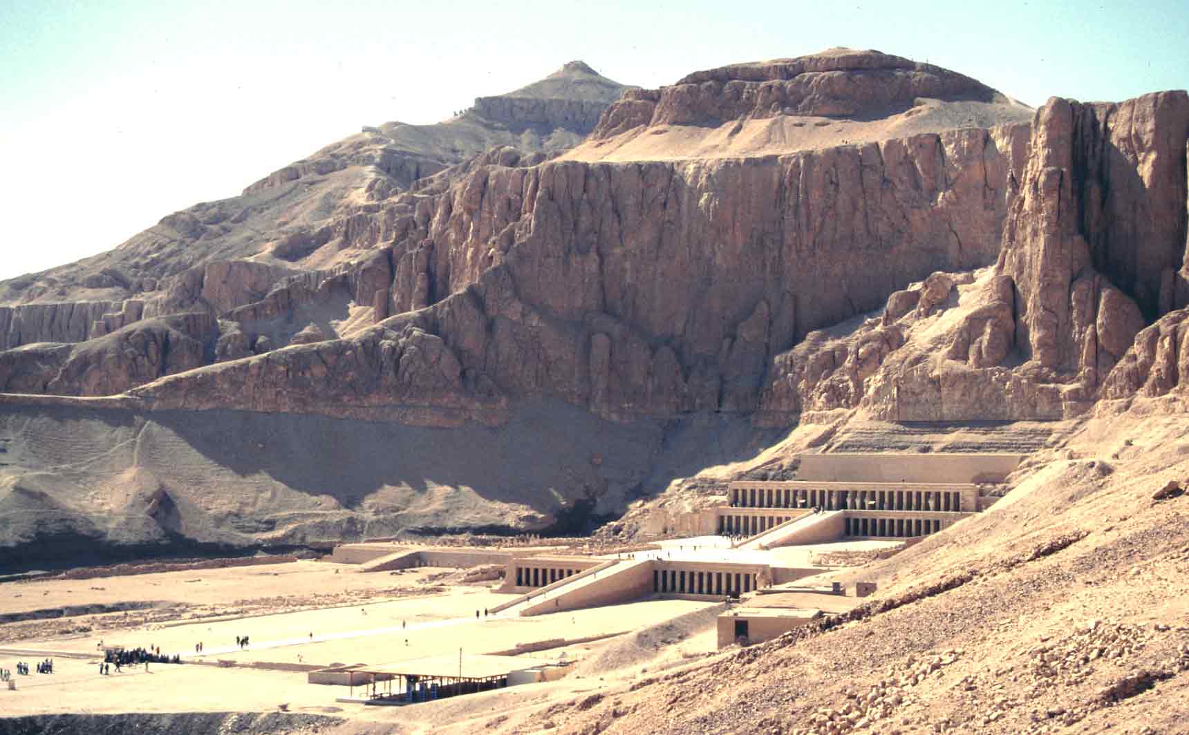
Here is an overview of the site of Deir el Bahri,
on the western bank of the Nile just opposite of Luxor. This picture
has been taken on the beginning of a footpath that leads from Deir el
Bahri to the Valley of the Kings, just behind
these imposing cliffs. On the horizon, you can see the pyramid shaped
top of "The Peak", as the ancient Egyptians called it: the mountain that dominates
the Valley of the Kings.
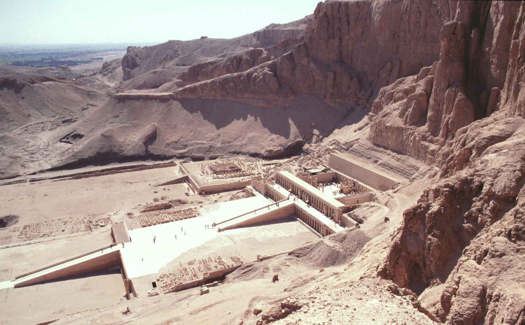
Here we have
started to rise a bit on our way up. We now have a better view on "M" behind "H". From here, it would
seem that Hatsjepsut copied Mentuhotep’s design on a much grander scale.
This is however a false impression. It is neither a copy, nor
on a grander scale.
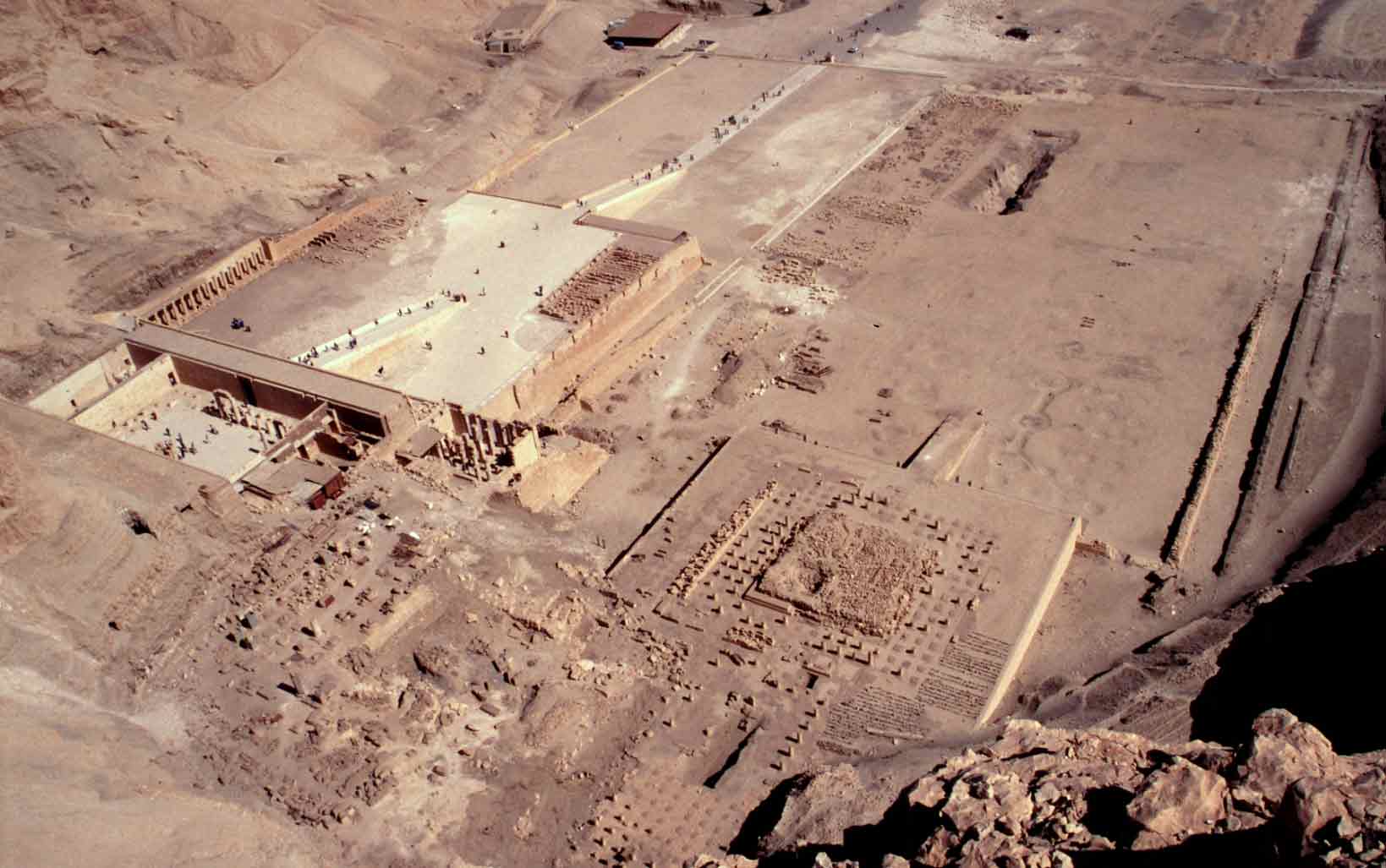
Here we are
on top of the cliffs, right above the two complexes. On the left is "H",
on the right "M".
*) On the right side of the ramp of "M", you can see a series of
circular depressions. These are the remains of planting holes for the
trees that once stood here. On the more detailed version of this
picture, you can also discern a few on the left of the ramp. Back to start Previous Next Thumbnails
|
|
|
|
|
All materials on this site are protected by copyright. All copyright by Sjef Willockx, unless otherwise indicated. |